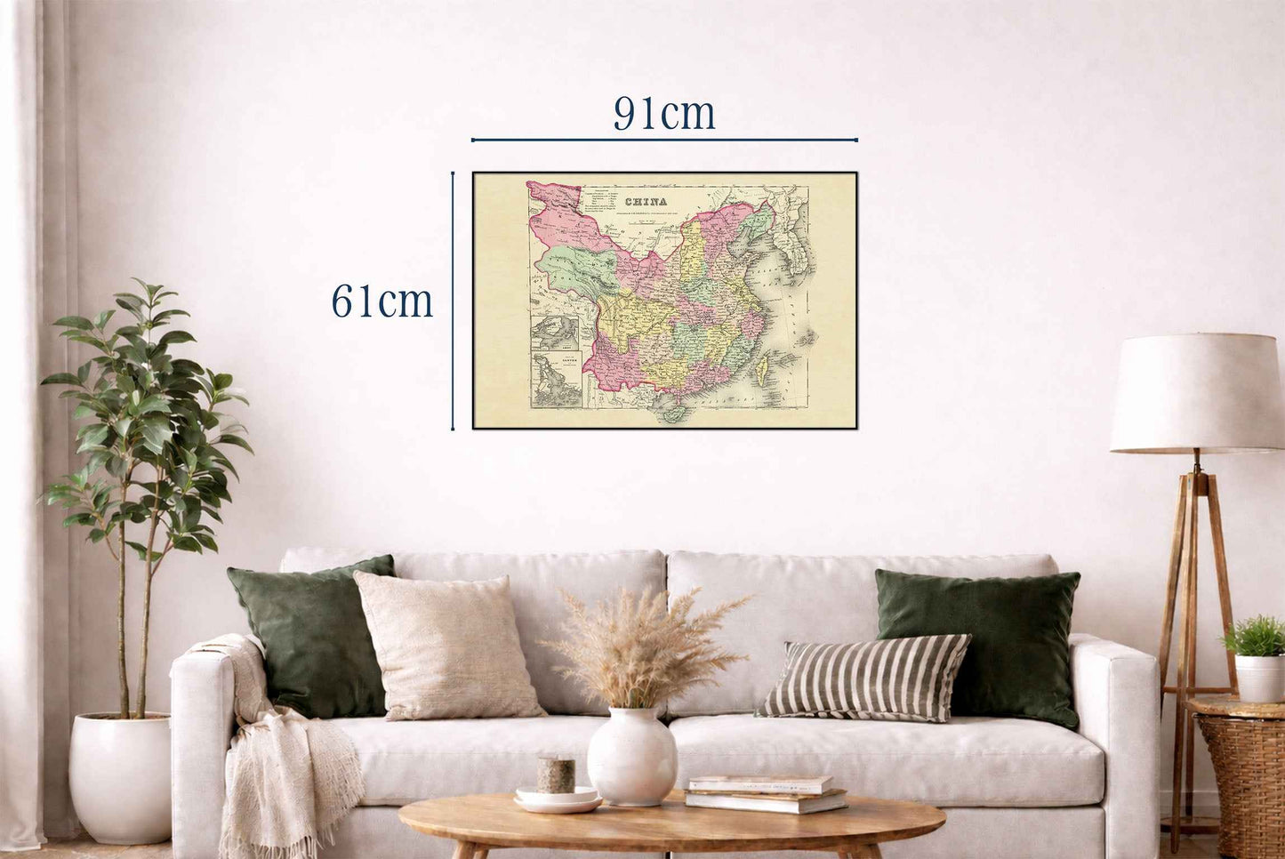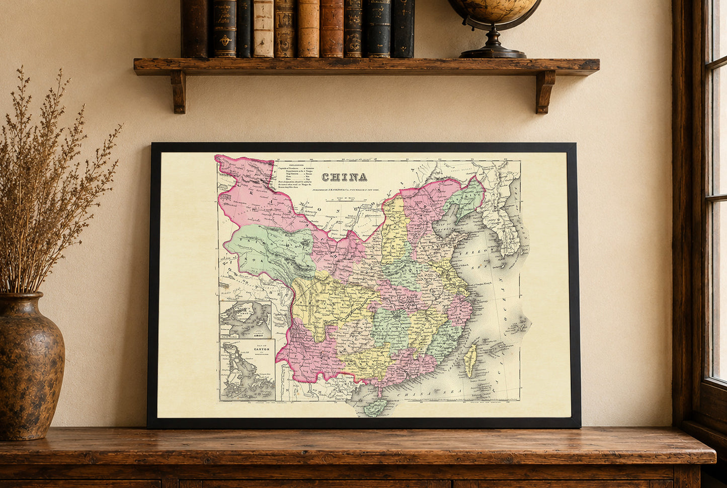


The map titled "China" was authored by G.W. Colton and published by J.H. Colton & Co. in 1856. It is part of Colton's world atlas, specifically featured in the large one-volume edition, which is noted to be scarcer than the two-volume version. The atlas is recognized for its fine accuracy and extensive publishing run, initially issued by subscription and in parts, with subsequent editions continuing for over thirty years. The map is rendered in full color by region, a common practice in 19th-century cartography to differentiate political boundaries. The vibrant colors help delineate the provinces of China, enhancing the visual separation of different administrative regions. The map is bordered with an intricate decorative pattern, typical of the period's cartographic embellishments, providing both aesthetic appeal and a sense of framing to the geographic content.
This is a reproduction print of a historical map