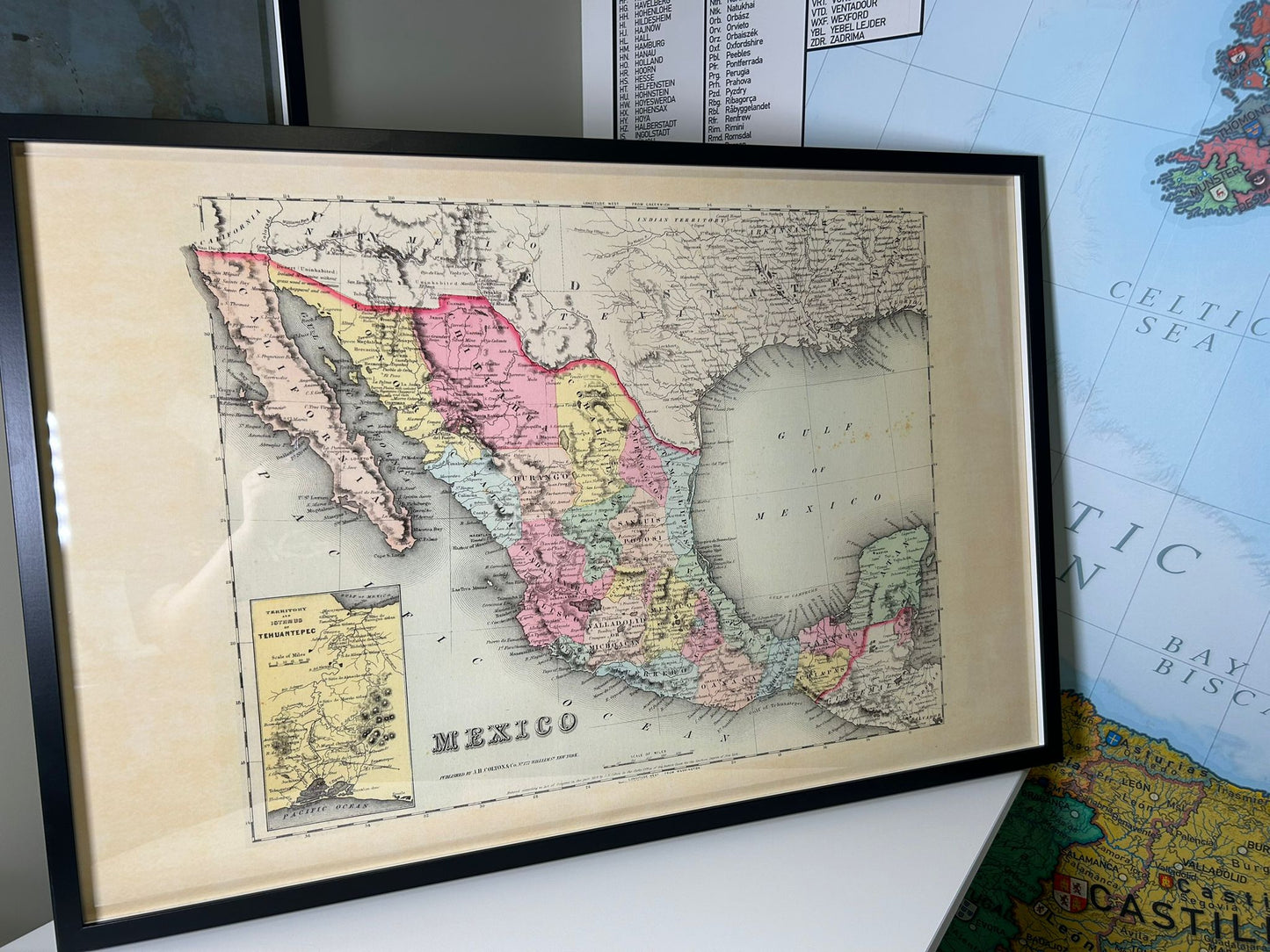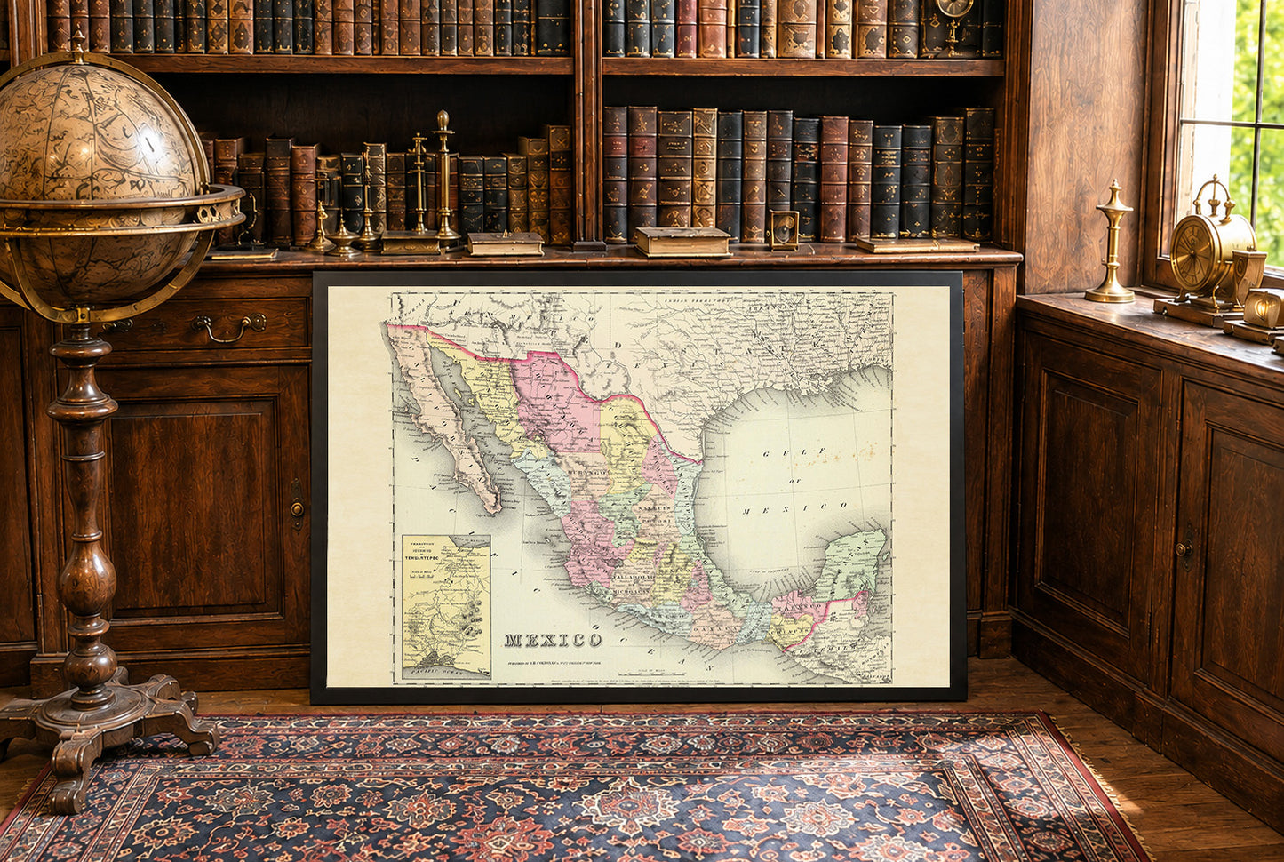


This map, titled "Mexico (with) Territory And Isthmus Of Tehuantepec," was crafted by G.W. Colton and published by J.H. Colton & Co. in 1856. The map is part of an atlas series that was recognized as one of the finest and most accurate of its period. The work is included in Colton's 1856 edition of the world atlas, which is notable for its extensive publishing run and detailed cartography. The map is an atlas map printed in full color, with distinct state boundaries highlighted through various shades. This use of color not only enhances the visual appeal but also aids in distinguishing between different regions and states within Mexico.
This is a reproduction print of a historical map