Skip to content
FREE SHIPPING FOR ORDERS ABOVE $200
Skip to product information
1 of 3

Ancient Greece Map Poster - Vintage Greek & Macedonian Historical Atlas Wall Art

€39,95
€39,95 €48,95
Sale Sold out

Lowest price in 30 days: €39,95 EUR

Frame style: Unframed
Size: 91x61cm | 24x36in
  • Free Shipping - On All Orders Over $250!
Secure Payment
  • American Express
  • Apple Pay
  • Bancontact
  • BLIK
  • Google Pay
  • Maestro
  • Mastercard
  • Shop Pay
  • Union Pay
  • Visa

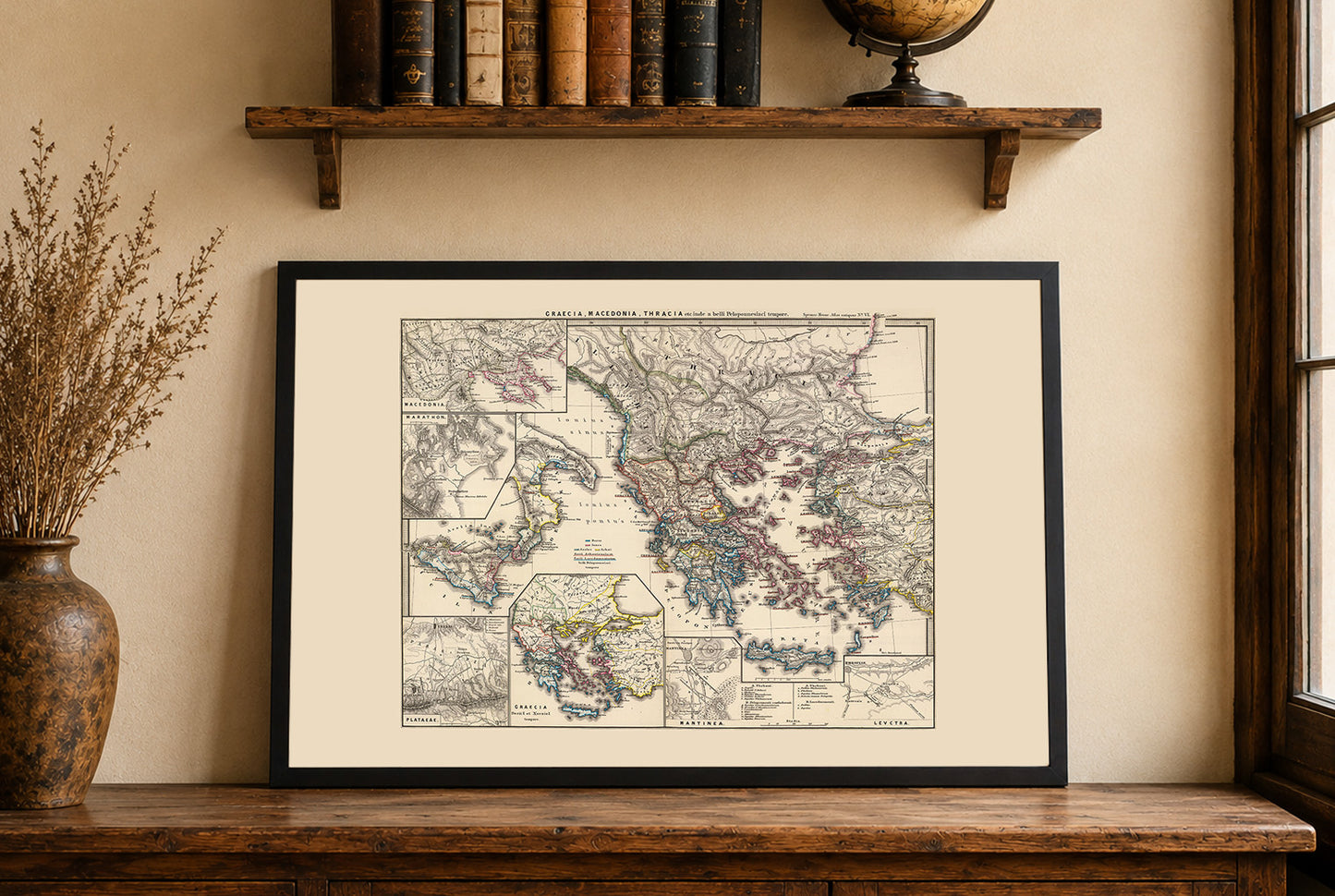
Discover a remarkable historical map poster titled “Graecia, Macedonia, Thracia etc. inde a belli Peloponnesiaci tempore,” created by Karl Spruner von Merz and Th. Menke in 1865. Published by Justus Perthes as part of the renowned “Spruner-Menke Atlas Antiquus,” this antique-style map presents a detailed view of Ancient Greece, Macedonia, and Thracia during the era of the Peloponnesian War.

This beautifully hand-colored atlas map features detailed topography with reliefs illustrated through hachures, a classic cartographic shading technique widely used in 19th-century mapmaking. The composition includes a central map of the Balkan Peninsula alongside inset maps highlighting important historical locations and battle sites such as Marathon, Plataeae, Leuctra, Mantinea, and Macedonia. These detailed inserts provide historical depth and visual richness, making the poster especially appealing to history enthusiasts and lovers of classical antiquity.

Printed in a refined vintage atlas style, this historical Greece map poster combines geographic precision with elegant antique aesthetics. It is an ideal wall decor piece for offices, libraries, studies, classrooms, or living spaces inspired by ancient history and classical civilization.

Perfect for collectors, historians, travelers, educators, and fans of Ancient Greece, this reproduction print brings the legendary world of classical antiquity into your home with timeless sophistication.

This is a reproduction print of a historical map

Author:
Menke, Th.

Date:
1865

Source: David Rumsey Map Collection, David Rumsey Map Center, Stanford Libraries

We use a top quality Canon printer
Canon ImagePROGRAF PRO 2600 providing:

  • 2400 x 1200 dpi
  • 12-color printing system using Lucia-PRO II inks
  • High-precision printing with 5 pl droplet size per color
  • Print head with nozzle compensation function

The print is done on Cotton Canvas (
390 g/m²) prociding a vintage map feeling.

Currently we offer black hardboard frames with polystyrene plastic front protection.

Available in sizes:

  • 91x61cm | 24x36in
  • 70x50cm | 28x20in

We work with a range of trusted logistics providers to ensure you get the best balance of cost and delivery quality, including FedEx, UPS, and DPD. We currently ship to 30 countries worldwide, including 25 countries within the European Union, as well as the United Kingdom, Switzerland, Canada, Japan and the United States.

All orders include full tracking, so you can monitor your shipment every step of the way. We also offer free shipping on all orders with a cart value above $200.

If your postal code is not supported by our standard shipping options, please contact us at contact@strategymaps.co
and we will arrange a custom shipping solution tailored to your location.

We have a 30-day return policy, which means you have 30 days after receiving your item to request a return. To be eligible for a return, your item must be in the same condition that you received it, and in its original packaging. You’ll also need the receipt or proof of purchase.

When buying within the European Union have the right to cancel or return your order within 14 days, for any reason and without a justification.

Read more about return policy here.

View Product Details

From map lovers for map lovers

Get Your Hometown Blueprint Map - Modern City Street Wall Art