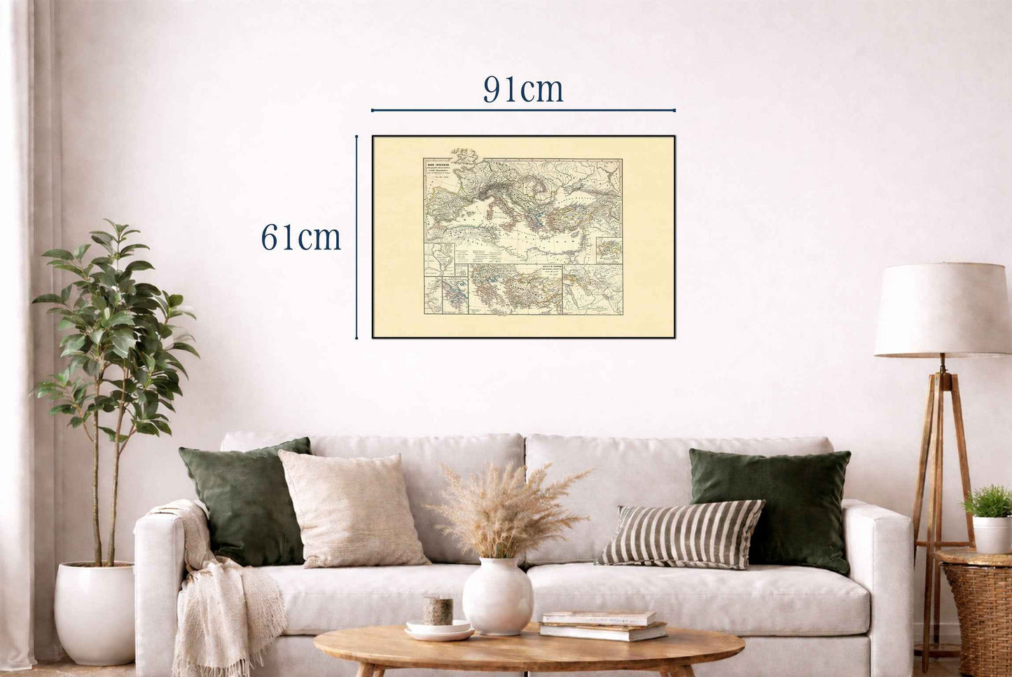


Explore the political and cultural landscape of the ancient world with this remarkable Ancient Mediterranean Map Poster, created by Karl Spruner von Merz and Theodor Menke in 1865. Published as part of the renowned Spruner-Menke Atlas Antiquus, this beautifully hand-colored historical map illustrates the Mediterranean region from the era of the Hannibalic Wars to the age of Mithridates, covering one of the most transformative periods in classical history.
Rendered with exceptional detail, the map depicts the ancient Mediterranean basin and surrounding territories, including Greece, Macedonia, Asia Minor, North Africa, and the Italian Peninsula. Political boundaries, major cities, trade routes, and geographic features are carefully identified, providing a comprehensive view of the civilizations that shaped the foundations of Western history.
Hand coloring distinguishes ancient kingdoms, republics, and spheres of influence, while hachures illustrate mountains and terrain, giving depth and dimension to the landscape. The map reflects the scholarly cartographic standards of the 19th century, combining historical research with elegant visual presentation.
Particular attention is given to the great powers of the classical world, including Rome, Carthage, the Hellenistic kingdoms, and the territories associated with Mithridates VI Eupator. Detailed inset maps highlight significant locations such as Carthage and the volcanic islands between Thera and Therasia, offering additional historical and geographical context.
The map captures the geopolitical struggles that defined the ancient Mediterranean, from the Punic Wars between Rome and Carthage to the expansion of Hellenistic influence and the conflicts that shaped the late Republican era. As both a historical document and decorative artwork, it offers a fascinating window into the interconnected civilizations of antiquity.
Perfect for historians, classicists, educators, students, and collectors of antique maps, this ancient history poster brings intellectual depth and timeless elegance to libraries, studies, classrooms, offices, and sophisticated interiors.
This is a reproduction print of a historical map