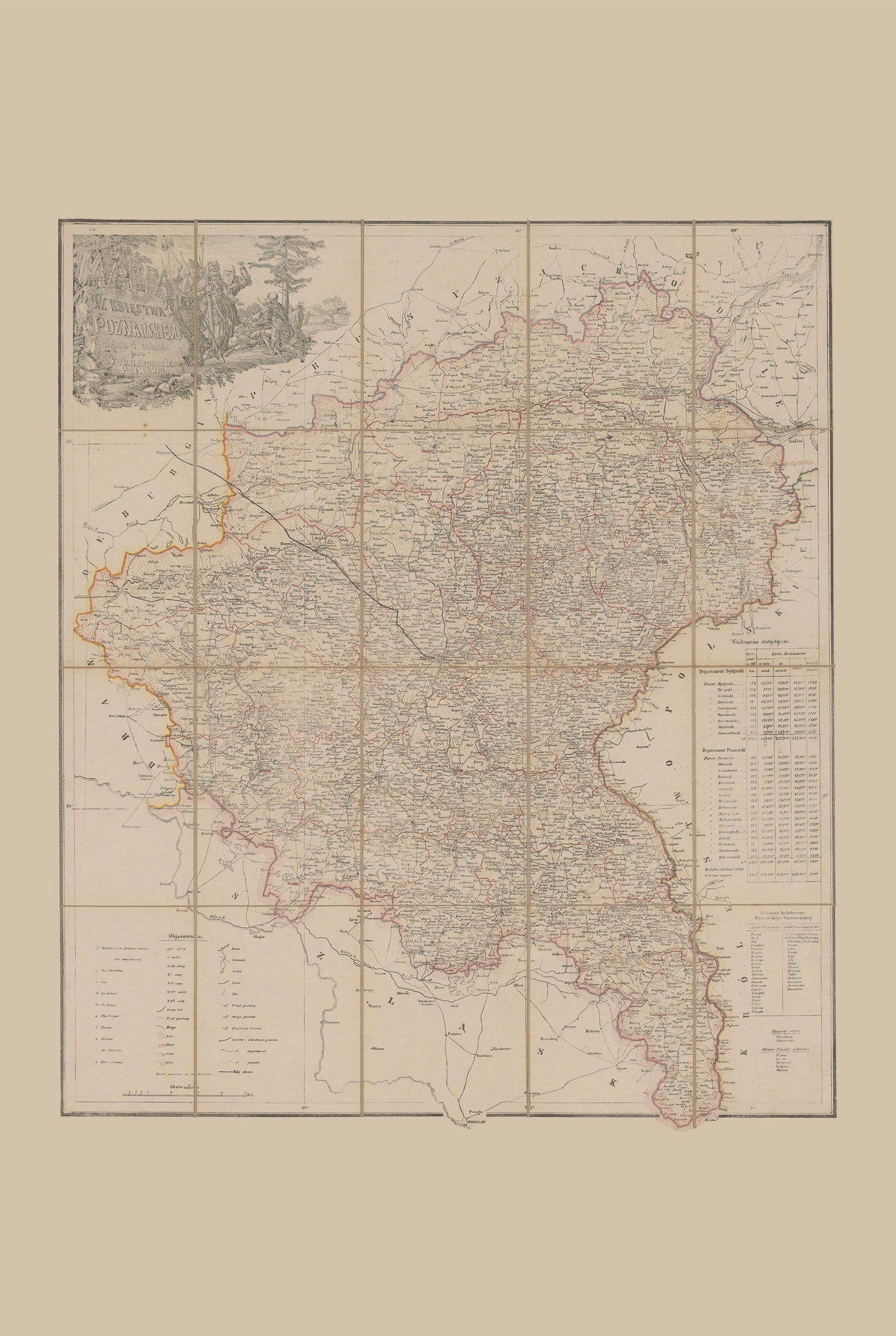
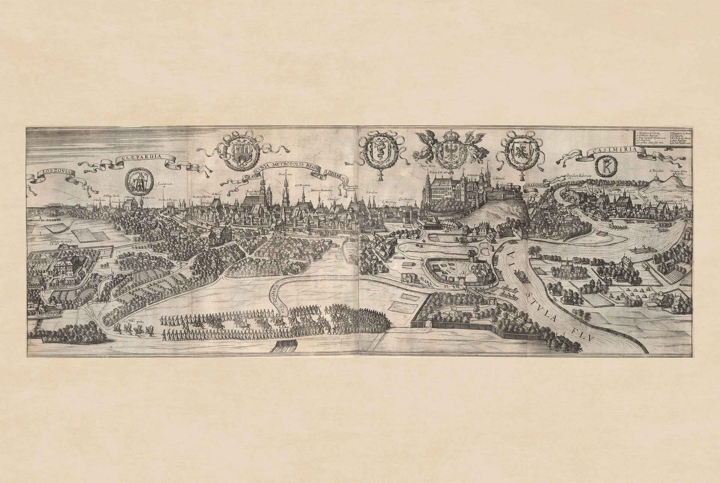
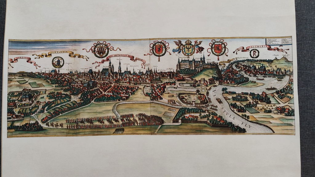
Discover the rich heritage of western Poland with this exceptional Grand Duchy of Poznań Map Poster, created by Wiktor Adam Kurnatowski in 1843 and engraved by Kajetan Wincenty Kielisiński. One of the most important nineteenth-century maps of the Grand Duchy of Poznań, this beautifully detailed lithograph presents both the geography and demographic composition of the region during the Prussian Partition of Poland.
Originally published in Poznań, the map illustrates the administrative divisions, counties, towns, rivers, forests, and terrain of the Grand Duchy, while also incorporating extensive statistical information about the population of the Bydgoszcz and Poznań Departments. Additional data concerning the archdioceses of Poznań and Gniezno reflects the cultural and religious landscape of Greater Poland during the first half of the nineteenth century.
The elaborate title cartouche, designed by renowned engraver Kajetan Kielisiński, depicts the legendary founder Lech leaning on his sword while receiving the White Eagle from a kneeling knight, accompanied by warriors and a wajdelota (Slavic bard). This patriotic allegory celebrates the origins of the Polish nation and makes the map one of the most artistically significant Polish cartographic works of its period.
Produced using fine lithographic printing with detailed hachure relief, the map combines scientific precision with symbolic national imagery. It was republished in 1861 and 1880, demonstrating its lasting historical importance and popularity among scholars and collectors.
Perfect for historians, genealogists, collectors, educators, and anyone interested in Polish heritage, this vintage Grand Duchy of Poznań map makes a distinguished wall decoration for offices, libraries, studies, classrooms, and traditional interiors.
This is a reproduction print of a historical map