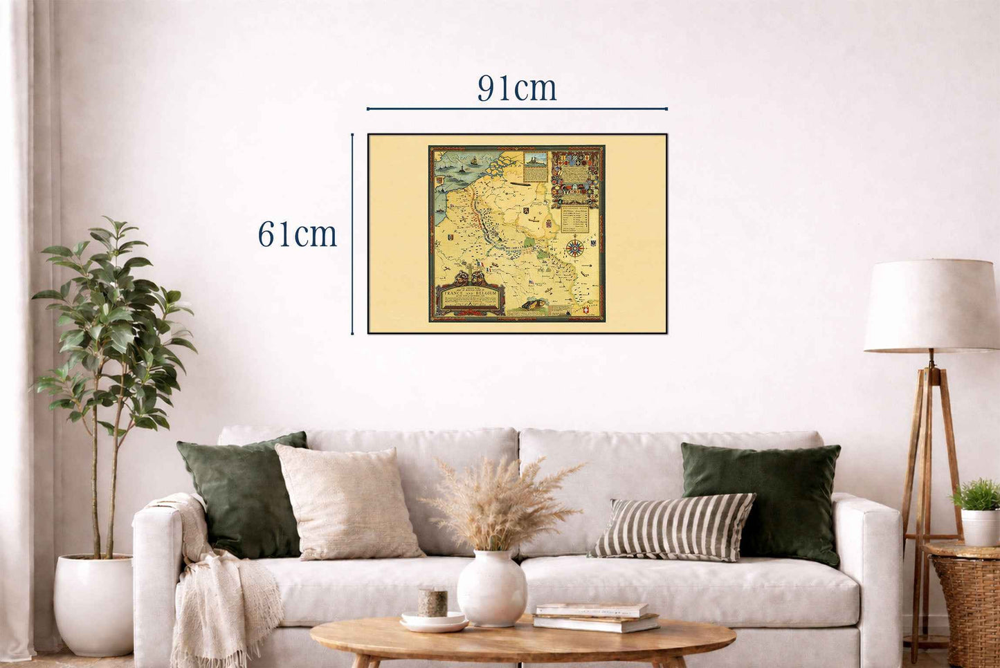


Explore one of the most detailed visual records of the First World War with this remarkable Great War Battle Lines Map Poster, designed by Ernest Clegg in 1926. Titled “The Great War Map of Battle Lines in France and Belgium on the 25th of September 1918,” this extraordinary pictorial map documents the positions of Allied and Central Powers forces during one of the decisive final phases of World War I.
Combining precise military cartography with rich decorative illustration, the map presents the Western Front stretching across France, Belgium, and into Germany. Detailed symbols, color coding, and explanatory keys identify military divisions and front-line positions, providing a comprehensive snapshot of battlefield deployments as they stood on September 25, 1918, just weeks before the end of the war.
Beyond its strategic military value, the artwork serves as a powerful commemorative tribute to the conflict. Ornamental borders, heraldic emblems, and national symbols celebrate the nations and armies involved, while richly illustrated corner panels feature tanks, aircraft, artillery, and other military innovations that transformed warfare during the early twentieth century.
Historical inscriptions throughout the map provide valuable context regarding troop deployments and campaign developments. Particular significance is given to records compiled under the supervision of Douglas Haig, making the map an important visual reference for historians and military researchers.
Created less than a decade after the Armistice, this map reflects both the historical importance and lasting memory of the Great War. Its combination of military detail, historical documentation, and decorative craftsmanship makes it one of the most fascinating World War I cartographic works of the interwar period.
Perfect for collectors, military historians, educators, genealogists, and enthusiasts of historical cartography, this World War I poster adds historical depth and intellectual character to offices, libraries, studies, classrooms, and military-themed interiors.
This is a reproduction print of a historical map