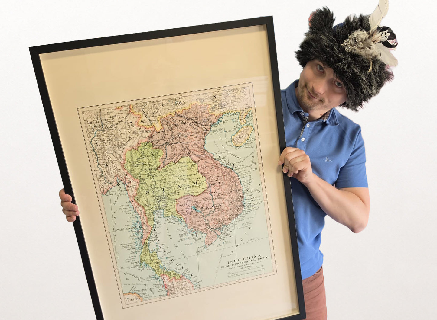


Explore Southeast Asia during the final decades of the colonial era with this fascinating Indo-China Map Poster, published by Edward Stanford Ltd. in 1926 as part of the prestigious Stanford's London Atlas of Universal Geography. Titled “Indo-China (Siam & French Indo-China),” this detailed lithographic map captures the political geography, transportation networks, and territorial boundaries of one of Asia’s most dynamic regions during the early twentieth century.
The map covers present-day Thailand, Vietnam, Laos, Cambodia, and portions of Myanmar, depicting a region undergoing rapid political and economic transformation. Thailand appears under its historical name Siam, while neighboring territories are shown as French Indochina, reflecting the colonial administration that shaped much of Southeast Asia during the period.
Rendered in vibrant color, the map clearly distinguishes political boundaries, provinces, and administrative territories. Major cities including Bangkok, Hanoi, and Saigon are prominently marked, offering insight into the region's principal centers of commerce, governance, and culture during the interwar years.
The map also highlights the growing infrastructure that connected Southeast Asia to global trade and communication networks. Railways, ports, and submarine telegraph cables illustrate the technological developments that transformed transportation and international communications across the region.
Relief is represented through traditional hachures, allowing viewers to appreciate the dramatic mountain ranges, river systems, and coastal landscapes that have influenced settlement, trade, and political development throughout Southeast Asian history.
As both a historical document and decorative work of cartography, this map provides a valuable snapshot of Southeast Asia before decolonization and the emergence of modern nation-states. It offers a unique perspective on the geopolitical landscape of the region during the final years of European colonial influence.
Perfect for historians, travelers, educators, collectors, and enthusiasts of Asian history, this vintage Southeast Asia poster brings historical depth and geographical intrigue to offices, libraries, studies, classrooms, and sophisticated interiors.
This is a reproduction print of a historical map