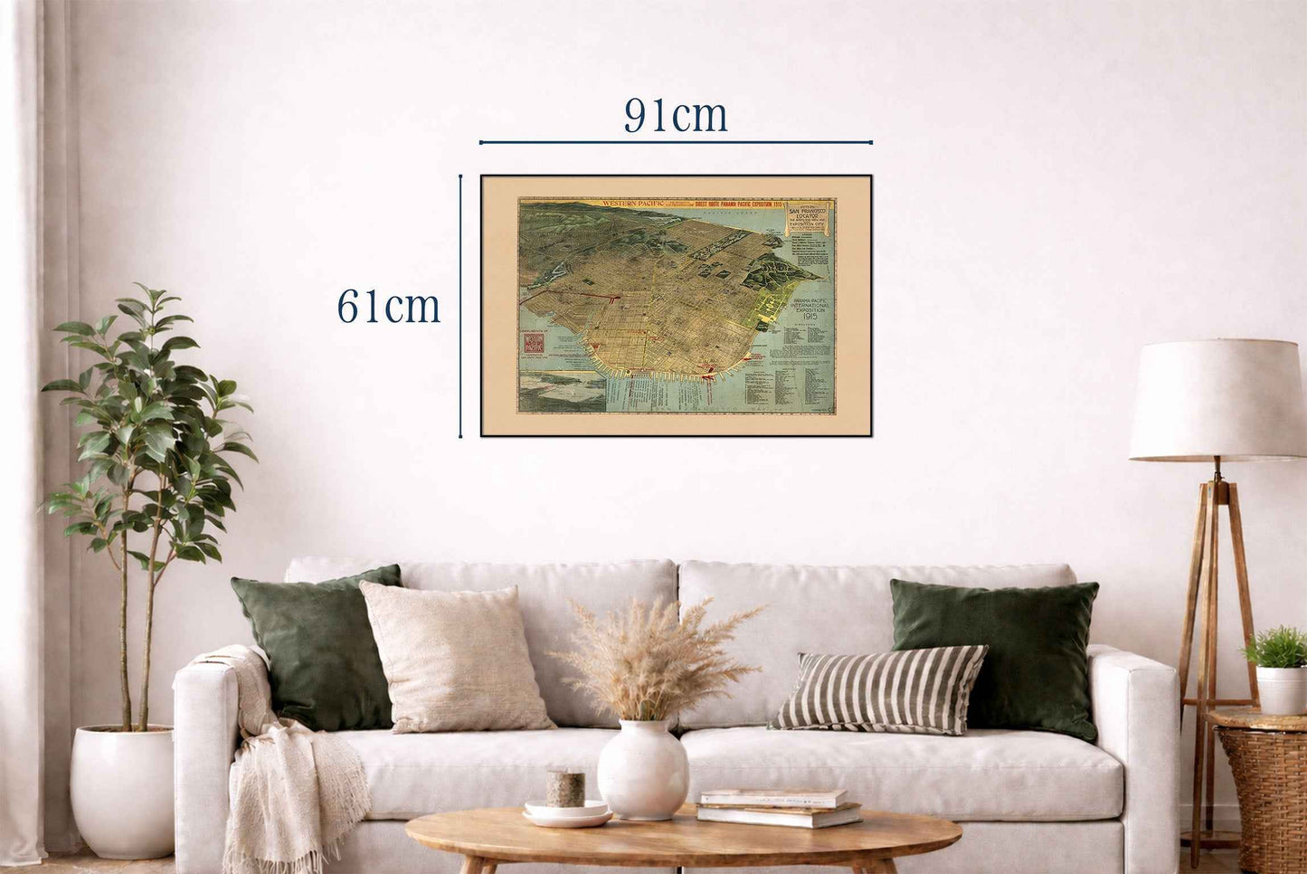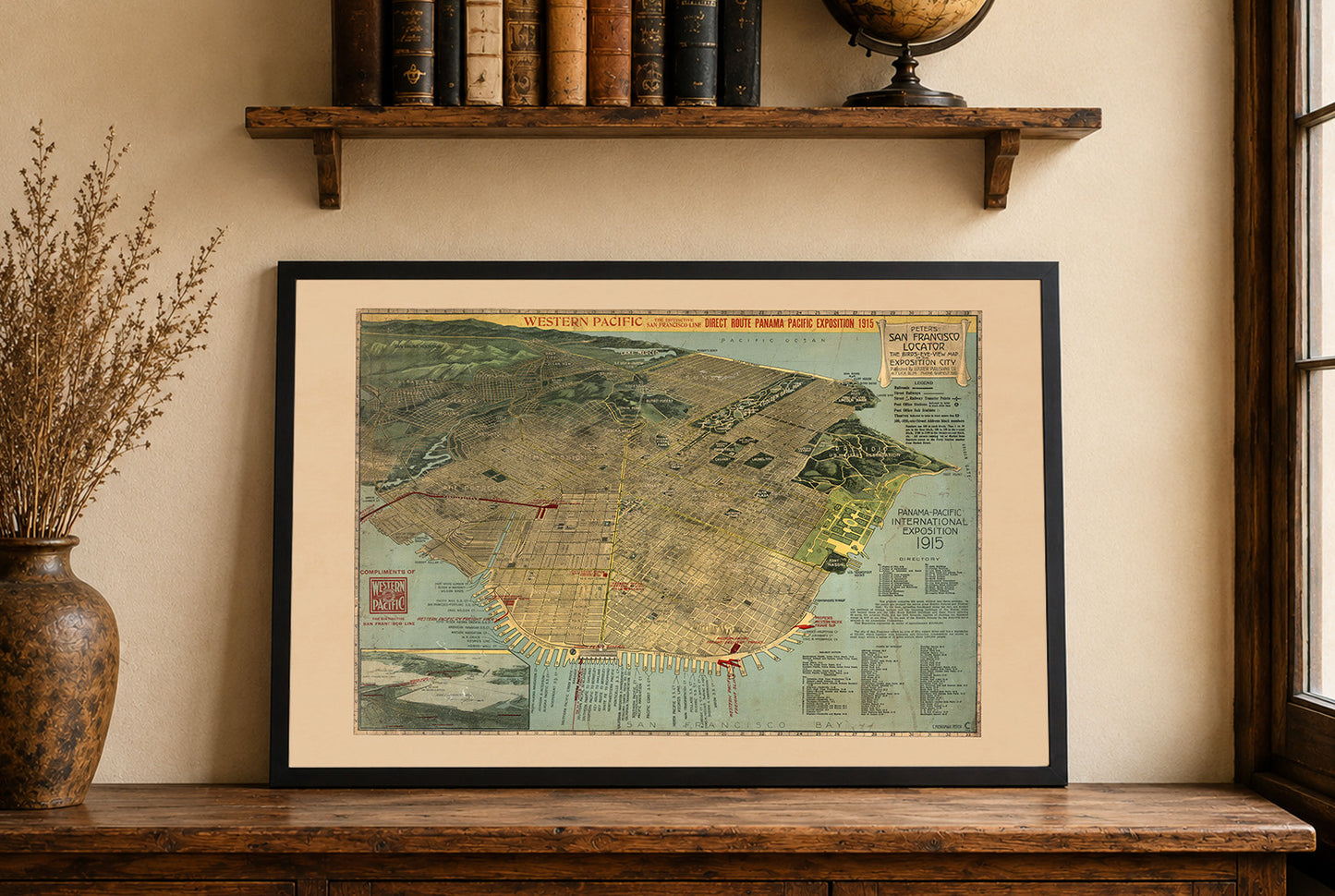


Discover early twentieth-century San Francisco through this spectacular San Francisco Exposition City Map Poster, created by C. Merriman Peter in 1914. Officially titled “Peter's San Francisco Locator: The Birds-Eye-View Map of the Exposition City,” this richly detailed pictorial map offers a fascinating aerial perspective of San Francisco during one of the city's most transformative periods.
Designed in anticipation of the famous Panama-Pacific International Exposition, the map presents an oblique bird’s-eye view looking southwest across the city. Combining cartographic precision with artistic illustration, it captures San Francisco's streets, neighborhoods, waterfronts, parks, and landmarks in remarkable detail, creating a vivid snapshot of the city at the dawn of the modern era.
Produced shortly after the devastating 1906 earthquake, the map reflects San Francisco’s remarkable recovery and growing international importance. The city is depicted as a thriving urban center prepared to welcome visitors from around the world to celebrate the completion of the Panama Canal and the achievements showcased at the 1915 World’s Fair.
Rich colors, carefully rendered architecture, and panoramic perspective give the map exceptional visual appeal. The bird’s-eye format allows viewers to appreciate the city's geography, street grid, and relationship to the surrounding bay while highlighting important buildings, transportation routes, and exposition-related locations.
Beyond its cartographic value, this artwork serves as an important historical document capturing San Francisco during a defining moment of civic optimism and economic growth. It remains a favorite among collectors of city maps, California history, and World's Fair memorabilia.
Perfect for historians, travelers, urban enthusiasts, and admirers of vintage cartography, this decorative San Francisco poster brings historical character and architectural charm to offices, libraries, studies, living rooms, and sophisticated interiors.
This is a reproduction print of a historical map