


Author: Ernest Dudley Chase
Year: 1935
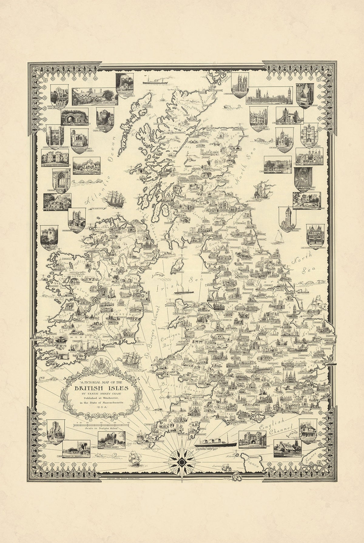
This is a reproduction print of the historical pictorial map “A Pictorial Map of the British Isles”, created and published by Ernest Dudley Chase in 1935.
The map presents the British Isles through hundreds of detailed illustrations, combining geography with architecture, history, industry and regional culture. Cities, notable buildings, monuments and local landmarks are depicted alongside scenes representing industries and other distinctive features of the region.
The surrounding seas are filled with ships and steamboats, reflecting the importance of Britain’s maritime heritage. An elaborate title cartouche, coat of arms, decorative border and prominent compass rose further enhance the map’s distinctive appearance.
Unlike many of Chase’s colorful pictorial maps, this work was produced in black and white, allowing its intricate line drawings and numerous miniature illustrations to dominate the composition. The original map measured approximately 43 × 59 cm.